
達發科技股份有限公司


Motorcycle Helmet Bluetooth Headset


Clear Communication with Your motorcycle Teammates
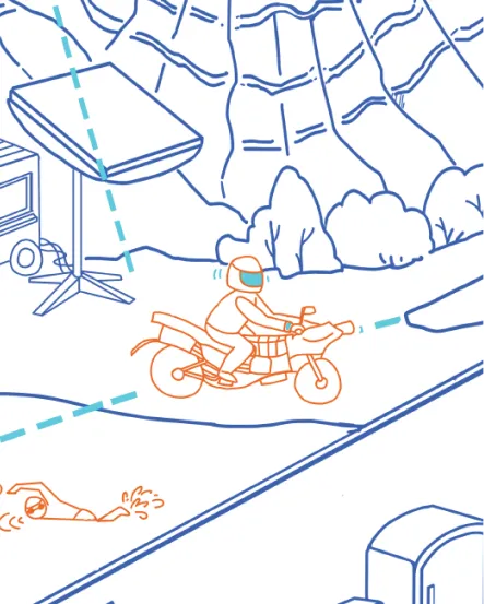
In the outdoor area on the top left of the image, we see bikers wearing the motorcycle helmet Bluetooth headset. Powered by Airoha’s Bluetooth audio chip, the headset enables biking team members to communicate in real time with crystal-clear audio, unaffected by wind noise. Riders can instantly share route updates, safety warnings, or other important information.
Targeted Noise-Cancelling Headphones

Enjoy Clear Communication Even in Noisy Environments
In the upper left corner of the imagine, representing an outdoor space, we see how, wth Airoha Technology’s Bluetooth audio chip with Full Adaptive ANC technology, your headphones can adjust automatically based on varying environmental conditions, effectively filtering out specific noises in outdoor spaces such as the one depicted on the upper-left of the image. While the industry standard operates at just 200 adaptive calculations per second, Airoha leads the way with up to 1,000 calculations per second, delivering more effective noise cancellation.
Racing Pigeon Satellite Positioning Flight Tracker

Accurately Recreating Flight Paths
In the upper-left section of the image we see a herd of racing pigeons. These birds are elite athletes of the sky, with some valued in the millions. High-quality training is crucial for them. Airoha Technology’s satellite positioning technology can be used to precisely track a pigeon’s flight path, accurately recording altitude, speed, and distance covered. Whether navigating stormy seas or crossing rugged mountains, Airoha’s GNSS chips provide precise tracking of the pigeon's movements. Additionally, leading clients across various industries harness their innovative research and development capabilities to create distinctive competitive advantages.
Livestock Tracker in Open Pastures
The Ideal Tool for Smart Farming
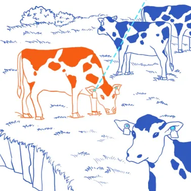
In the outdoor space depicted on the top left of the image, it is crucial for livestock owners to keep track of high-value cattle. Airoha Technology’s dual-frequency satellite positioning chips can be integrated into collars or ear tags, providing real-time location tracking. This is especially important in large-scale grazing, where ranchers can consistently monitor the location and activity of their cattle, preventing loss or theft. Additionally, leading clients across various industries harness their innovative research and development capabilities to create distinctive competitive advantages.
Satellite Positioning and Navigation Instruments for Yachts and Fishing Boats
Accurate Navigation, No More Getting Lost at Sea
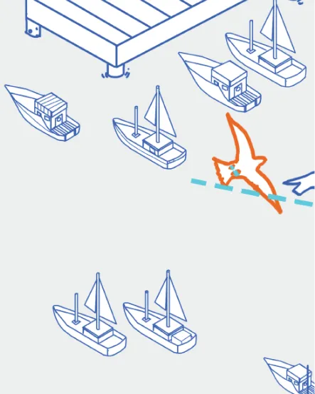
In the public space depicted on the bottom left of the image, we see how Airoha’s GNSS chips, integrated into the navigation systems of small and mid-sized fishing boats and yachts, enable fast and accurate positioning by predicting satellite orbits and mapping ephemerides. These chips continuously provide precise satellite positioning data, ensuring that vessels can always determine their exact location and direction, even in the vast expanse of the ocean.
Open Water Sports Watch
Swim Freely in Open Waters
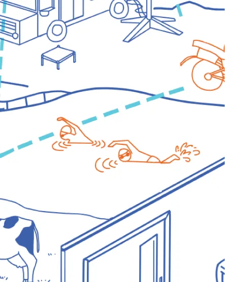
On the right side of the upper-left corner of the image, we see a sports watch equipped with Airoha's GNSS chip. The watch is capable of quickly locking onto satellite signals and providing precise positioning during the brief moments it surfaces from the water, making it perfect for open water swimming environments. The chip delivers highly accurate data, enabling swimmers to track their position and adjust their pacing, helping them refine their workout strategy.
Pet Tracker
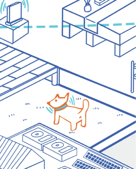
Always Keep Track of Your Pet
In the central-lower section of the public space, we see how pet trackers equipped with Airoha Technology’s GNSS chip allow owners to pinpoint their pet’s exact location at any time, enabling you to effortlessly monitor your pet's recent movements. With a tracker like this, you’ll never have to worry about your pet getting lost or wandering into the neighbor’s yard again.
Wireless Lawn Mowing Robot
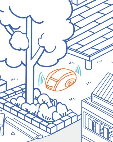
Interference-Free, Precision Mapping
In the centre-lower portion of the public space, we see a wireless lawn mowing robot powered by Airoha’s GNSS chip. This robot operates seamlessly even in areas prone to signal interference, such as shaded spots, corners or along fences. It consistently delivers precise data, ensuring no missed areas during mowing.
Cycling Watch
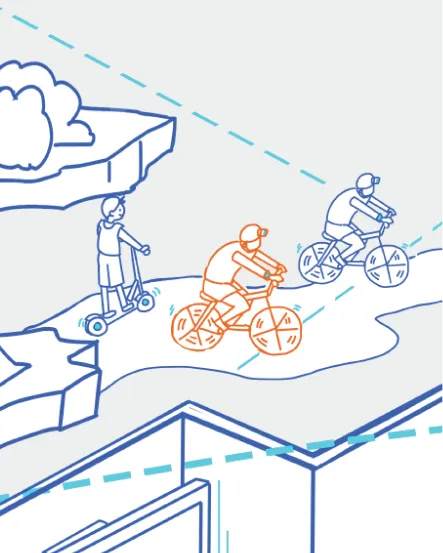
The Ultimate Aid for Cyclists
On the bottom right of the image we see an urban environment featuring highrise buildings. The in-vehicle inertial navigation system commonly used in cars relies on GNSS signals; however, these signals are easily obstructed or reflected by tall buildings, elevated roadways, basements, tunnels, or dense forests, leading to interference. Airoha Technology addresses this issue with ‘AI Satellite Selection’, which reduces positioning time and enhances the reliability of positioning. Even in urban environments or dense forests, this technology ensures precise navigation.