
達發科技股份有限公司


Racing Pigeon Satellite Positioning Flight Tracker


Accurately Recreating Flight Paths
In the upper-left section of the image we see a herd of racing pigeons. These birds are elite athletes of the sky, with some valued in the millions. High-quality training is crucial for them. Airoha Technology’s satellite positioning technology can be used to precisely track a pigeon’s flight path, accurately recording altitude, speed, and distance covered. Whether navigating stormy seas or crossing rugged mountains, Airoha’s GNSS chips provide precise tracking of the pigeon's movements. Additionally, leading clients across various industries harness their innovative research and development capabilities to create distinctive competitive advantages.
Livestock Tracker in Open Pastures
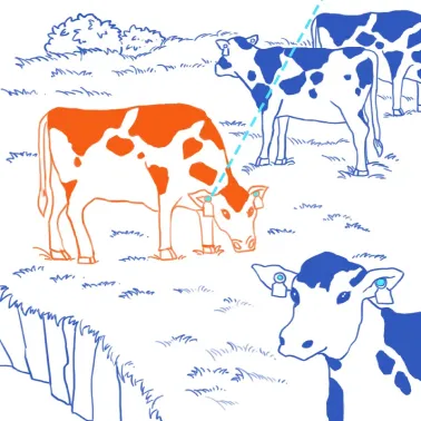
The Ideal Tool for Smart Farming
In the outdoor space depicted on the top left of the image, it is crucial for livestock owners to keep track of high-value cattle. Airoha Technology’s dual-frequency satellite positioning chips can be integrated into collars or ear tags, providing real-time location tracking. This is especially important in large-scale grazing, where ranchers can consistently monitor the location and activity of their cattle, preventing loss or theft. Additionally, leading clients across various industries harness their innovative research and development capabilities to create distinctive competitive advantages.
Satellite Positioning and Navigation for New Energy Vehicles
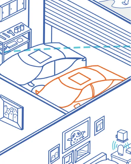
Extreme Precision in Challenging Conditions
Let’s focus our attention on the family parking space in the centre of the image. As we enter the era of fully autonomous vehicles, GNSS chips play a crucial role in enabling centimetre-level positioning and precise movement tracking. This is essential for real-time driving decisions and route planning. Our AEC-Q100 automotive-grade reliability certified GNSS chips ensure consistent and accurate satellite tracking even under harsh weather conditions and complex road environments.
Satellite Positioning and Navigation Instruments for Yachts and Fishing Boats
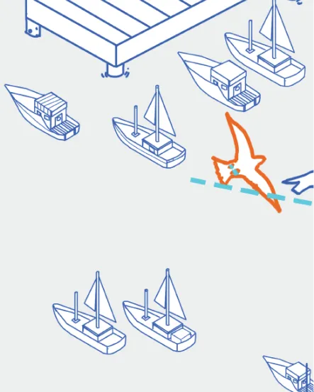
Accurate Navigation, No More Getting Lost at Sea
In the public space depicted on the bottom left of the image, we see how Airoha’s GNSS chips, integrated into the navigation systems of small and mid-sized fishing boats and yachts, enable fast and accurate positioning by predicting satellite orbits and mapping ephemerides. These chips continuously provide precise satellite positioning data, ensuring that vessels can always determine their exact location and direction, even in the vast expanse of the ocean.
Open Water Sports Watch
Swim Freely in Open Waters
On the right side of the upper-left corner of the image, we see a sports watch equipped with Airoha's GNSS chip. The watch is capable of quickly locking onto satellite signals and providing precise positioning during the brief moments it surfaces from the water, making it perfect for open water swimming environments. The chip delivers highly accurate data, enabling swimmers to track their position and adjust their pacing, helping them refine their workout strategy.
Pet Tracker
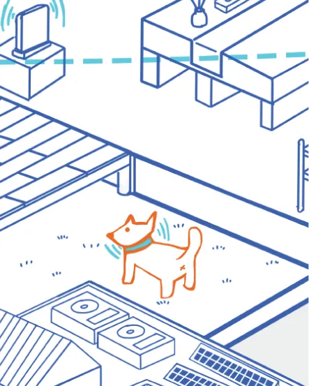
Always Keep Track of Your Pet
In the central-lower section of the public space, we see how pet trackers equipped with Airoha Technology’s GNSS chip allow owners to pinpoint their pet’s exact location at any time, enabling you to effortlessly monitor your pet's recent movements. With a tracker like this, you’ll never have to worry about your pet getting lost or wandering into the neighbor’s yard again.
Wireless Lawn Mowing Robot
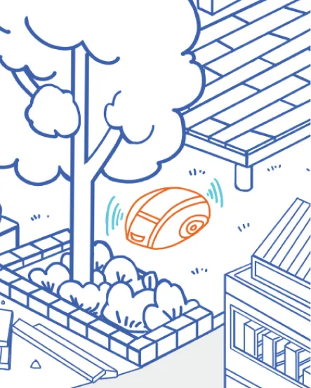
Interference-Free, Precision Mapping
In the centre-lower portion of the public space, we see a wireless lawn mowing robot powered by Airoha’s GNSS chip. This robot operates seamlessly even in areas prone to signal interference, such as shaded spots, corners or along fences. It consistently delivers precise data, ensuring no missed areas during mowing.
Cycling Watch

The Ultimate Aid for Cyclists
On the bottom right of the image we see an urban environment featuring highrise buildings. The in-vehicle inertial navigation system commonly used in cars relies on GNSS signals; however, these signals are easily obstructed or reflected by tall buildings, elevated roadways, basements, tunnels, or dense forests, leading to interference. Airoha Technology addresses this issue with ‘AI Satellite Selection’, which reduces positioning time and enhances the reliability of positioning. Even in urban environments or dense forests, this technology ensures precise navigation.
Automotive Inertial Navigation (Dead Reckoning)

Overcoming Obstacles for Precise Positioning
In urban environments, GNSS signals are often obstructed or reflected by tall buildings, elevated roadways, basements, tunnels and dense forests, leading to signal interference. However, Airoha Technology’s AI-based satellite selection and inertial navigation technologies reduce positioning time and enhance reliability, ensuring accurate positioning even in urban environments.
Satellite Positioning and Timing Module Receiver

Precise Positioning and Timing for Various Applications
Let’s move our attention to the atomic clock, depicted here in the middle of the public space area on the bottom-right of the image. Atomic clocks such as this one have a wide range of applications, including standard timekeeping systems and stock trading, both of which require precise positioning and timing. Airoha’s GNSS chips enable base stations to achieve accurate positioning and synchronize with satellite atomic clocks, ensuring ultra-precise timing with an error margin as small as ±2 nanoseconds.
Police Body Camera
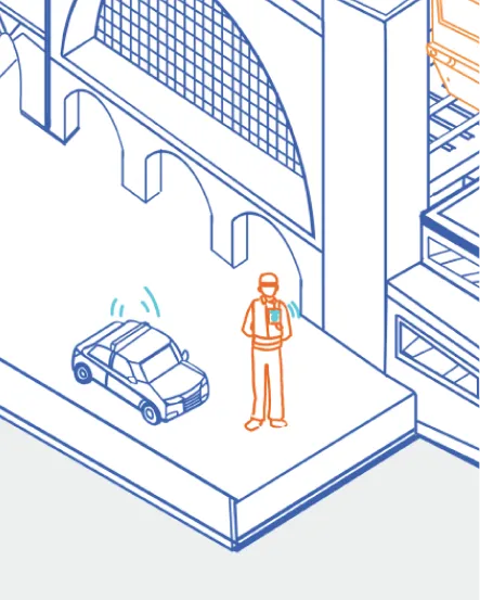
Accurate Tracking and Reliable Positioning
In the public space area on the bottom left of the image, we see how, in situations where tracking or immediate support for law enforcement officers is needed, police body cameras equipped with Airoha Technology's GNSS chip can precisely record geographical location and time stamps—information which may prove invaluable during subsequent investigations and legal proceedings.
Rugged Laptop for Specialized Applications
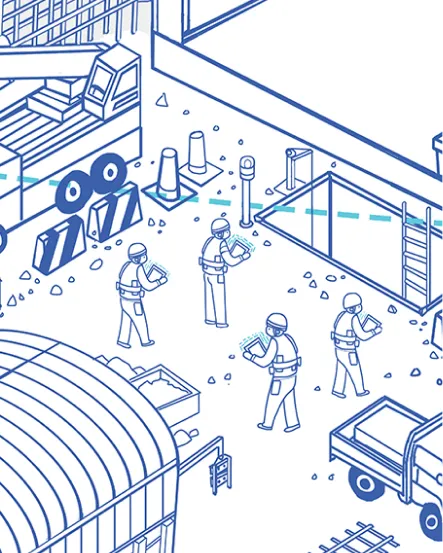
Accurate Positioning When it Matters Most
In the centre of the public space area on the bottom left of the image, we see a rugged laptop. These appliances are widely deployed in non-traditional office environments like law enforcement, firefighting and construction sites. Running on Windows 10 or later versions, users can utilise the Windows Location Service (WLS) for position sharing. The combination of WLS and Airoha Technology’s GNSS chip, featuring RTK high-precision positioning technology, ensures accurate location data in any outdoor environment and can assist in tasks such as land surveying, coordinating firefighting teams and reporting real-time locations.
Smart Grid
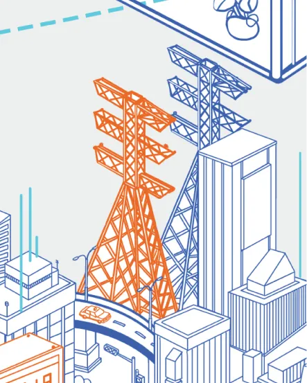
Deployment and Maintenance of Smart Grids
In the upper portion of the bottom-right corner, we see how Airoha’s GNSS chip, when embedded in Grids base stations, enables precise positioning of their locations. This allows for the efficient identification of damaged power towers and utility poles spread across cities, significantly improving maintenance and repair efficiency.